_1@2x.png)
About GravityView Maps geocoding
Geocoding is the process of converting an address to geographic coordinates (Latitude and Longitude). Geocoding can be done manually or automatically.
In both cases a Google Maps API key must be set up.
Manually
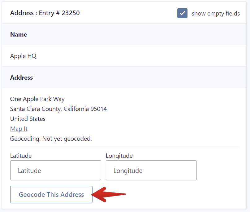
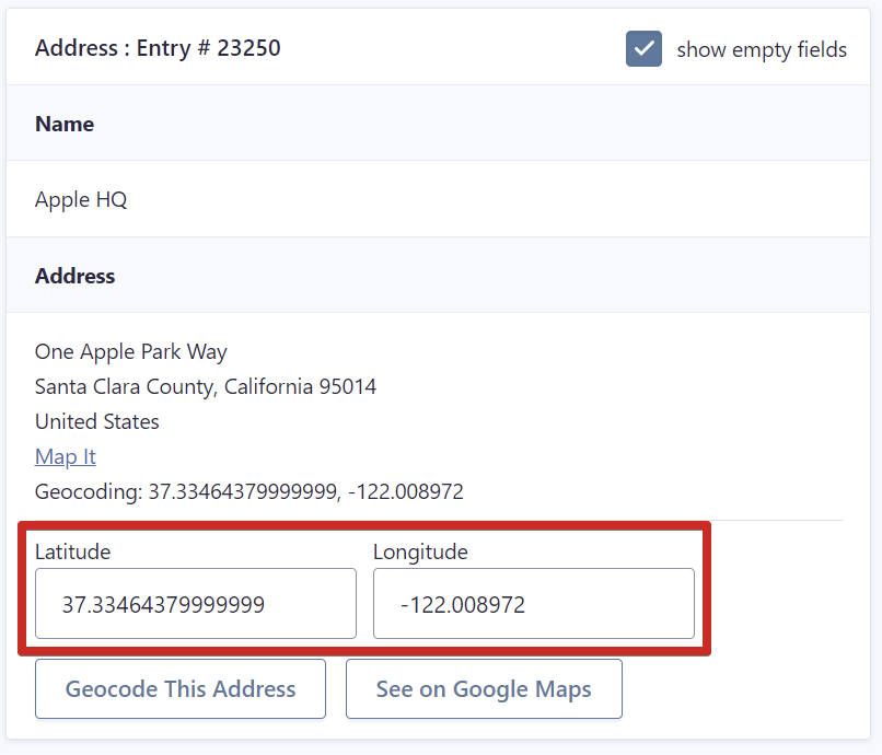
Entries that were not automatically geocoded after the form submission, can be manually geocoded later by viewing the entry details in the Entries page of the Gravity Forms menu and clicking in the "Geocode This Address" button right below the address field of the form. This action will send the address field data to Google via an API request and a latitude and longitude will be returned.
Automatically
Entries can be automatically geocoded when one of these two settings are used:
A) By enabling the geolocation autocomplete option in the address field of your form.

B) By activating the automatic geocoding option in the View Settings of your View.
